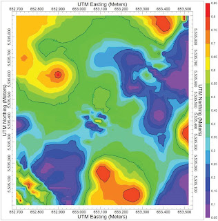
An indispensible collection of mapping, modeling, analysis and display tools, now available as a stand-alone program. The RockWorks Utilities (also included in the full RockWorks package) provides geologists and engineers an amazing array of essential geotools, all for only $599!
 Main program features
* Contour maps
* 3D surfaces and terrain models
* Gridding tools
* Solid modeling
* Volumetrics
* Piper diagrams, Stiff plots, Durov diagrams, and other hydrochemistry tools
* Stereonets
* Rose diagrams, and other structural geology tools
 * Point and multivariate symbol maps
* Land grid maps
* 3D objects
* Ternary diagrams and other statistical tools
* Geotechnical tools
* Import/Export
Related Products
RockWorks: Project-wide management and interpolation of borehole data, with mapping, cross sections, fence diagrams, solid models, and much more. Shares data with LogPlot.
LogPlot 7: A companion package for generating detailed boring logs, well logs, mud logs, with almost unlimited flexibility in log layout. Shares data with RockWorks.
RockWorks GIS Link: Import your RockWorks borehole locations into ArcMap, and generate cross-sections, profiles and fence diagrams using ArcMap and RockWorks14.
0 komentar:
Posting Komentar